Otterton History - Stantyway Farm

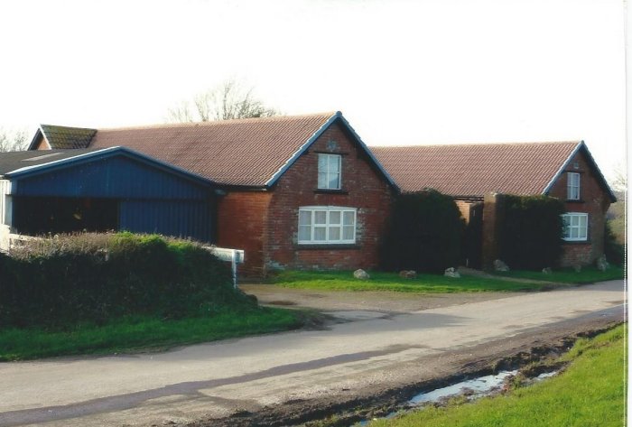
STANTYWAY FARM 1968, FORE
STREET,OTTERTON
Tithe Nos. 1048, 1050, 1051, 1052a
Conven. Rental Nos. 11, 12, 76
The 1986 Listed Buildings lists 5 buildings of
which the farmhouse is probably 16th. century, a
threshing barn with large double doors early 17th.
century and another barn of 18th. century. This
indicates that the farm was one of the three
existing main farms in Otterton that may have been
of 15th. century origin established at the time of
the Otter Estuary ports.
The earliest reference seen is in the Auction of
1779 which lists two small farms each with House
and Courtlage grouped around a yard leased by 1)
Abraham Skinner with 21 acres; 2) by William
Hutchins 19 acres, including 3 Fields called
Bradlands. The two farms were merged into one unit
in 1818.
By the Tithe 1843/6 and Rack Rent Account for
1844, William Harding is holding Nos.12 & 76
and probably the 7 acre part of No.11. He is named
in 1850 Whites Directory. There is also a new
Rental No. 191. The whole is described as
“Skinners & Tapes” of 72 acres of arable with
two Houses Nos. 1048 & 1051 on Tithe Map. Rent
£59.(The name “Tape” is probably the name of a
previous farmer).
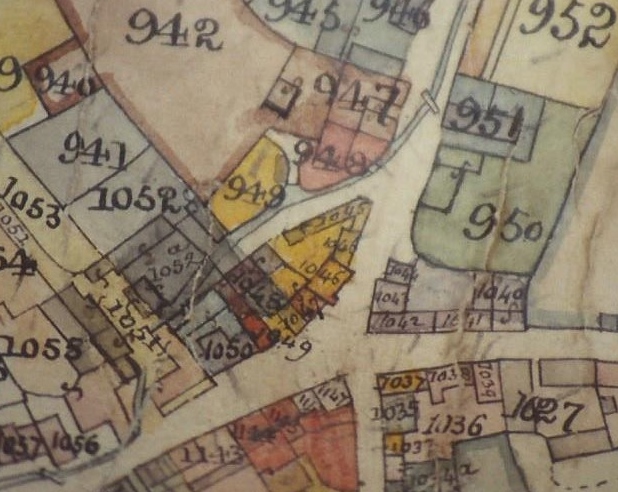
Tithe Map Stantyway Farm in centre
The 1844 Tithe Map shows the two Houses standing
at opposite ends of the yard, east & west. The
later farmhouse No. 1050 known today in Fore
Street replaced 1048 & 1051 where new barns
were built. No.1052a is the 17th.century threshing
barn. (Now No.3 Stantyway Court). The Map also
shows the Otterton Brook flowing through the
centre of the Yard. This was later covered over.
In 1852 there was a major reorganization of 10
Holdings in the Parish including “Skinners &
Tapes”. It was relocated to Thomas Tedbury jnr.
“Part Robins, Tapes and Skinners Farms”, 115 acres
Rent £140. (His father was the village
Saddler)This was part of the grouping of farm
lands into larger compact units throughout the
Estate with the farmstead remaining in the
village. The Coldridge Survey of 1861 shows the
holding as 121 acres with the buildings as “ some
modern and good, others bad”. The good ones
probably were built to replace the houses
1048/1051.
By 1870 Directory the farm is first named
“Stantyway”, named after the Saxon open strip
fields which lay where the present day Stantyway
Farm is today. At least 19 acres are still part of
the holding.
The 1883 Directory is the first to name Thomas
Tedbury’s son Daniel as holder, still 121 acres.
Rent £133 pa.
By 1911 Survey, Daniel is farming 125 acres. Rent
£156. The buildings are described as “a well road
farm with good cob and slated house, some
buildings adjoining, and others in fields near
village. All buildings in very fair order”. Daniel
is still there in 1914, but by 1926, son John is
farming.
The farm changed hands and in 1939 Sydney Williams
jnr. Is holding. The family held the farm
buildings in the Village through the Second World
War until 1986.
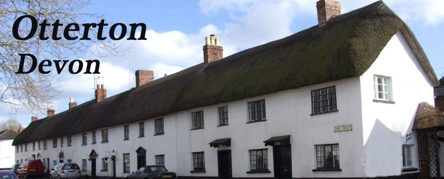
Stanyway Farmhouse 2016
In 1885 a labourers cottage had been built in the
Stantyway Fields above the Village as part of the
Rolle Estate scheme to improve living conditions
for its tenants. The cottage was enlarged and
farm-buildings constructed there and
the Williams family moved there in 1986. They
continued farming the enlarged 264 acres. Two
years later the Village farmhouse and
farm-buildings were sold by the Estate at Auction
with outline Planning Permission and listed
buildings consent for conversion to the site seen
today.
2015 the Williams vacated the farm which has been
merged into the Clinton Devon Farms Partnership.
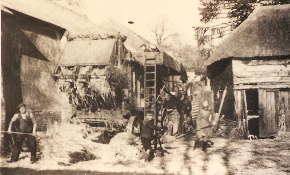
Stantyway Farm, Threshing 1940’s
© Gerald Millington 2016
SOURCES
Clinton Devon Estates Archives
|