Otterton History -
Otterton Bridges
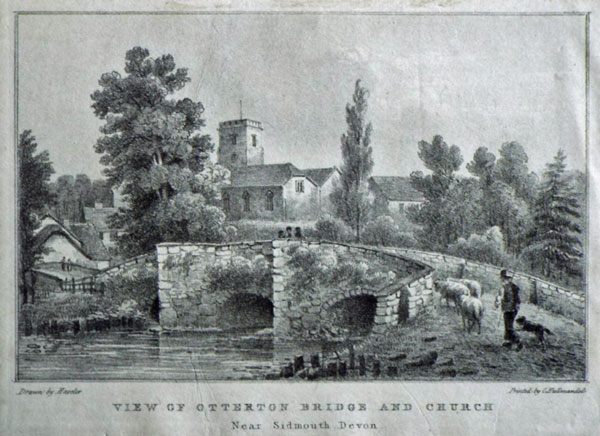
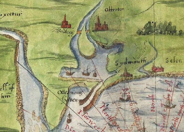
1825
Print Otterton Bridge & Church by Haseler
OTTERTON BRIDGES During
Saxon times and into the 14th. century the Otter
River was too wide to permit the construction of a
bridge from the west bank to Otterton village and
it was not fordable. For two miles or more
up-river from the sea it was about 600 metres wide
bounded by the red cliffs we see today. While
being very evident on the east bank they appear
occasionally on the west side. It is believed that
gradual silting of the river had probably begun
during or before Saxon times and by 1086 Otterton
Mill had been built on a sand spit at the entrance
to Otterton harbour. The river had reduced in size
and a ferry was in use to cross at this point. A
ferryman is mentioned in “Devonshire Transactions”
for 1893 which reads “A cottage occupied by
Nicholas Passag (meaning ferryman), at or near the
mouth of the River Otter”. A field on Anchoring
Hill above Otterton is named Firry Anchor.
By 1540 “a plan among
the papers of Lord Burghley” shows a large island
in the centre of the river opposite Otterton and
East Budleigh with two bridges linking either
shore.
C1540/1579
Map in British Library (Royal MS 18 D111)
It is probable that in
due course the western side of the island silted
up leaving the bridge on the eastern side at the
Mill. Was this the packhorse bridge illustrated in
the 1825 Print?.
In September 1808 James
Green had been appointed Surveyor of Roads and
Bridges for Devon. He was either a pupil or
assistant to the famous canal engineer, John
Rennie. He was responsible also for building the
embankment on the Lower Otter Valley at that time.
For the next 34 years he was further responsible
for 237 bridges in Devon bringing them up to a
good standard. Over the River Otter he built
bridges at Weston, Fenny Bridges, Gosford, Cadhay,
Newton Poppleford and Otterton, all with three
span arches, and all have survived exceptional
floods, including that of 10th. July 1968. 10
other bridges were swept away at that time. Other
serious floods have taken place since that time.
1907
(Third arch off right)
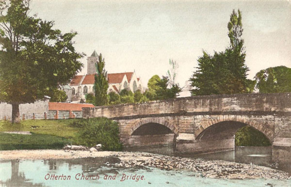
Mr. Green
built the present Otterton Bridge in 1827.
1988
Two
further bridges were built to the west when the
railway from Budleigh Salterton to Tipton St.
Johns was built 1894/97 to help flood waters
disperse quickly.
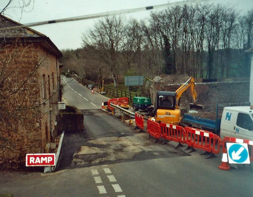
By 1999 due to the use
of traffic, especially heavy lorries and farm
machinery, the bridge sustained structural damage
when the western end subsided by an inch and
repairs had to be made.
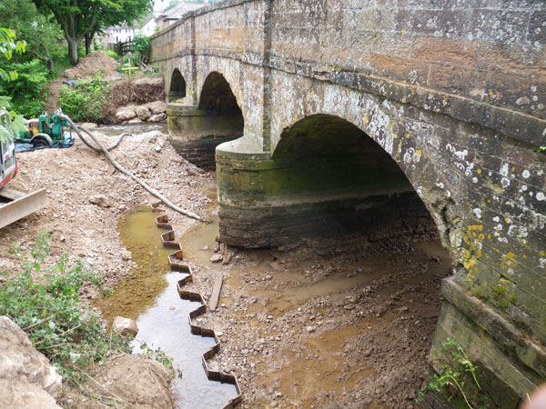
Due to dredging
upriver, by 2010 further work had to be carried
out to strengthen the bed of the River underneath
the bridge piers. A skirt of girders was
constructed around the piers.
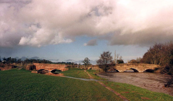
The leat
bridge carrying traffic into the village, and the
Mill leat, were probably built in the 16th.
century. Before this an arrangement of sluices and
trunks would have taken water directly off the
Otter River to drive the Mill Wheel without
impeding access to the harbour. As silting
continued and Otterton Harbour gradually silted up
completely , becoming unusable, the need for a
mill leat became necessary. The leat bridge was
probably rebuilt when the main bridge was rebuilt
in 1827. While strengthening the leat bridge in
2003 the Devon Count Council found evidence of an
earlier bridge underneath supporting the present
bridge.
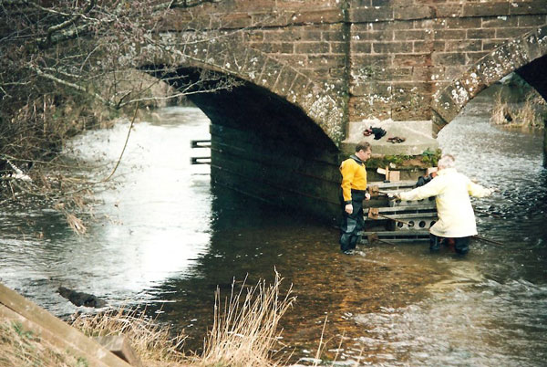
Leat
Bridge Repairs 2004
The steel
railway bridge was erected over the track in 1896.
The road out of Otterton had to be rerouted to
bring it close to the entrance to the railway
station, which was named “East Budleigh Station”.
The railway was closed in 1969 and the station
buildings redeveloped as housing. The bridge has
been strengthened in recent years to take heavy
traffic.
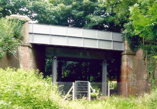
Railway
Bridge 2016 (See under Otterton History Pages
“Railway History”)
Clamour
Bridge
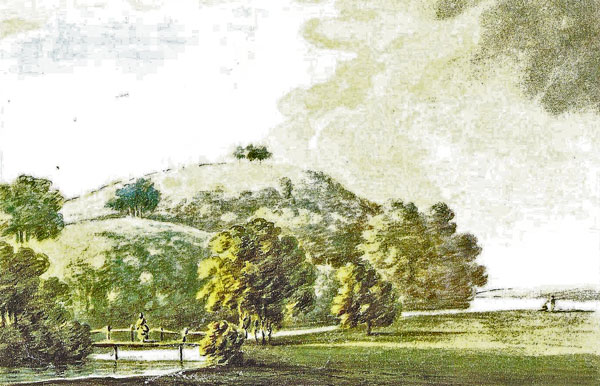
1795
Painting by John Swete
The bridge appears in a
painting of otterton park by revd.John swete on
his perambulations in 1795. It shows a view of the
river otter with the warren (hill) in the
background and a delightful grouping of trees with
a primitive wooden bridge over the river and a
lady standing in the middle. The plan drawn up by
james green proposing the embankment in 1808 has a
brief line drawn across the river at its present
day site. In his letter to lord rolle dated
12th.July 1808, giving his specification for the
embankment he states” the budleigh brook, which
now runs into the river otter by various
channels.........Should be conveyed directly into
the river a little below the wood bridge at the
park”. The admiralty in its report on the
embankment of 1851, marks and names it as
clamor(sic) bridge and this is the first use seen
of the name of the bridge.
It takes its
name-clamour- from a field , once part of the
colever open-field of the middle ages . It is
listed as no.1335 on the otterton tithe
award.-arable 4 acres. And is part of a holding
known as “ashfords”. The field lies on the high
ground above the bridge and to the east of park
lane. The other two fields of ashfords were furze
hill 2 acres and colever 1acre. It is not known
where the name clamour comes from but could be a
family name. It does not appear in the various
subsidy rolls etc. Of the 16th.Century . Clamour
bridge is not marked on the otterton tithe map.
The ashford family are recorded in otterton
1632/1728. Many fields are named after their
holders, as are cottages and farms.
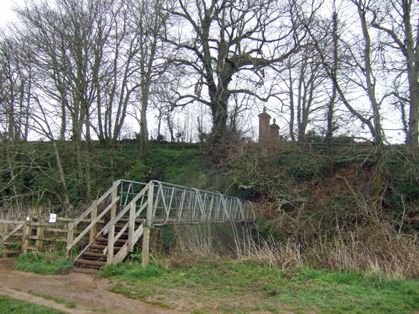
CLAMOUR
BRIDGE, MARCH 2014 Note Pillars above “entrance to
Park”. Clamour field to left of pillars.
White
Bridge
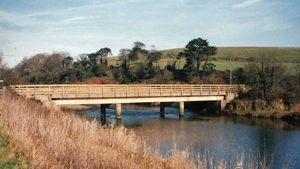
White
Bridge 1996
The first
bridge known, crossing the River Otter to link
South Farm with South Farm Road and Kersbrook to
the west is marked on the Otterton Tithe Map
1844.It had probably been built much earlier, as
early as the building of South Farm in 1802.
This
photograph shows a bridge over the river with
cottages Nos.1 to 3 South Farm Road in the
background. These cottages are dated MR1906 which
suggests that this is the original South Farm
Bridge which was not demolished until some years
after the new South Road bridge was constructed in
1888. Access to South Farm became difficult owing
to pile driving for the bridge foundations in the
River. (Letter Books, CDE)
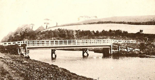
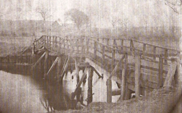
South
Bridge 1910 In the exceptional floods of February
1930 this bridge was swept away and replaced by
White Bridge. In 1953/4 White Bridge needed urgent
repairs and the Estate Report of 1953 states “The
bridge at South Farm had to be re-built”
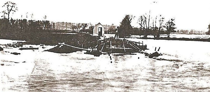
The
destruction of South Bridge February 1930
© Gerald Millington 2016
SOURCES
Clinton Devon Estates Archives
|